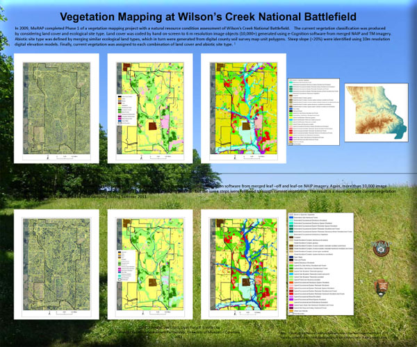

MoRAP worked with the National Park Service (NPS) as part of a nationwide vegetation mapping effort. This portion of the project was conducted at George Washington Carver National Monument and Wilson’s Creek National Battlefield in Missouri, and Pea Ridge Military Park in Arkansas.
Objectives
Basic products include:
- Quantitative samples and analyses of data for all major current vegetation types.
- A vegetation report with vegetation types named according to or cross-walked to the most current version of the provisional National Vegetation Classification content based on field plot sampling and tabular summaries of plot data by vegetation.
- A fine-resolution current vegetation map for the park with appropriate attributes in a GIS database.
- A key to classified vegetation types.
- Photos that represent all mapped types.
- Classification plot data entered into the most recent existing version of the NPS Vegetation Inventory PLOTS database.
- An accuracy assessment report of the final map produced independently.
Project Files
-
To request a final report or other documents available for this project click the link. Please include the name of the project in your request.
- MoRAP Contact Information
