MoRAP develops, analyzes, and delivers geospatial data for environmental resource planning and management. Our staff has worked on a wide variety of projects across the Midwestern and Southern US.
Missouri Soil and Atmospheric Monitoring Plan and Soil Maps Development
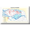
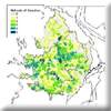
We are partnering with the Missouri Climate Center and Missouri Department of Natural Resources to develop a soil moisture monitoring plan for the state of Missouri and to develop a modeling/computing framework that generates daily statewide soil moisture maps to be used in the forthcoming Missouri Hydrology Information Center (MoHIC) dashboard.
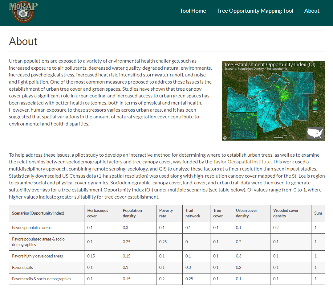
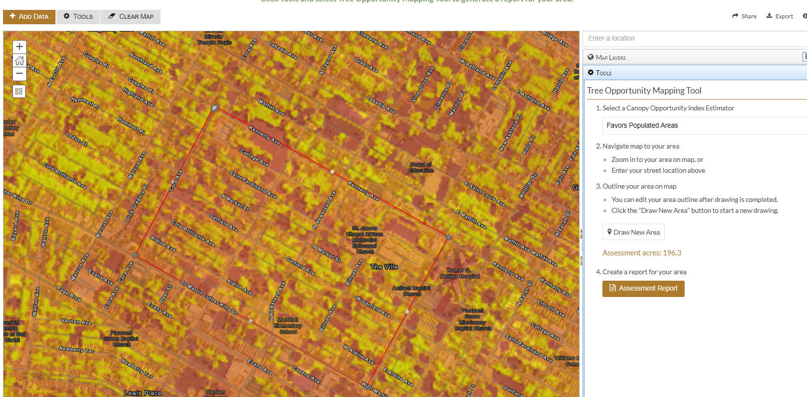
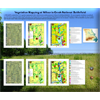
Mapping Tree Planting Opportunities in the St. Louis Region
We partnered with researchers at Saint Louis University (Taylor Geospatial Institute) to examine relationships between tree cover and sociodemographics, and to use suitability modeling to establish opportunity indices for tree planting in the St. Louis region. This work was deployed in a web mapping tool, which enables users to interactively draw areas of interest and generate suitability and demographic reports to facilitate urban tree canopy planning efforts
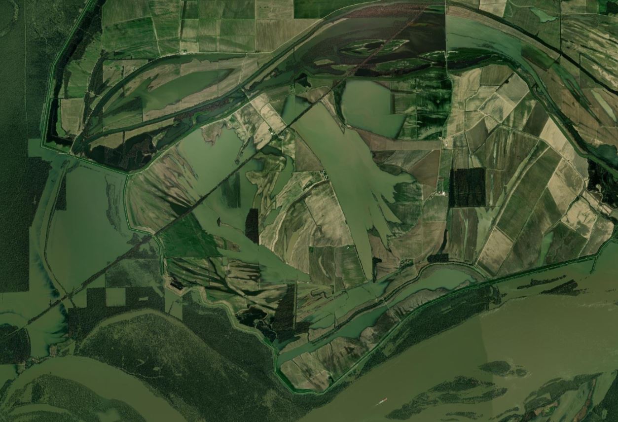
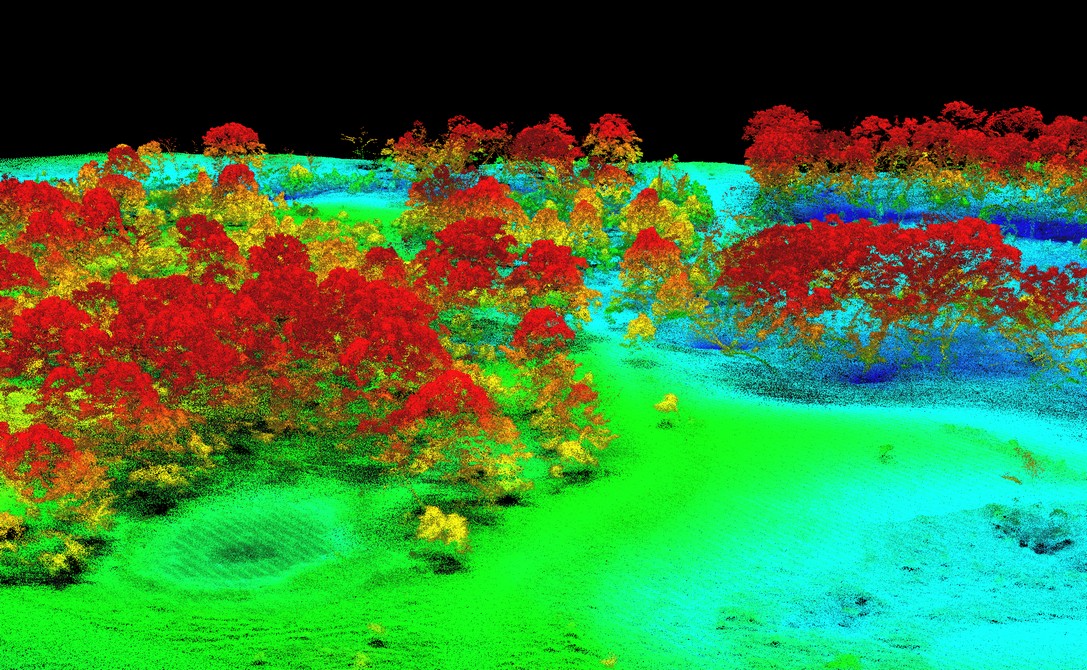
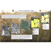
Enhancing Conservation Management at Prairie Fork Creek Conservation Area through the use of Precision Remote Sensing and Integrated Modeling
We are using UAV-based LiDAR and multispectral imagery, fused with high-resolution satellite data to produce high quality land-cover, vegetation, and terrain models for the Prairie Fork Conservation Area. Additionally, we are leveraging these data to advance invasive species mapping approaches.
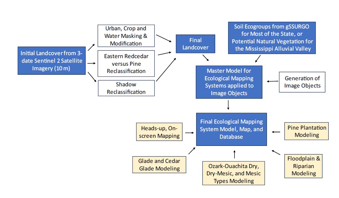
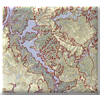
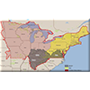
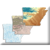
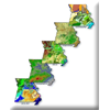
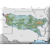
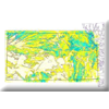
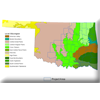
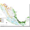
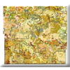
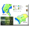
Ecological Mapping Systems of Arkansas: A Habitat Classification Tool to Facilitate Conservation Prioritization and Action for Species of Greatest Conservation Need
MoRAP worked with state leaders from several agencies in Arkansas, led by the Arkansas Fish and Game Commission, to initiate this project, with the aims of facilitating conservation prioritization and actions for habitats and species of greatest conservation need.
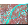
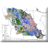
Key elements of the Arkansas EMS datasets include (1) use of 1704 georeferenced ground data points to drive the outcomes, (2) use of multiple dates of European Space Agency Sentinel 2 satellite imagery which allowed for mapping at 10 m resolution, (3) use of local, state-based ecological expertise to define the location and geophysical setting for EMS mapping targets, and (4) use of a number of ancillary datasets to improve landcover mapping accuracy and to increase the number of EMS types mapped, A total of 123 EMS types were mapped in Arkansas, including common cultural and ruderal landcover and vegetation such as pine plantation and developed types. Ozark-Ouachita Dry-Mesic Forest covered the most area, 17.51% of the state. Row crops covered 17.16%. Twenty-five pine or pine plantation EMS types covered 19.73% of the state, with Ozark-Ouachita pine woodland or mature pine plantation covering 6.15%.
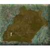
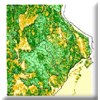
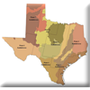
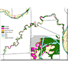
Improving Texas Ecological Mapping Systems for Southern Texas Coastal Counties
MoRAP mapped 22 Enduring Feature (EF) types and 66 Ecological Mapping Systems (EMS) for eight coastal counties in south Texas, from Refugio and Aransas County south to the Mexican border, using a multi-faceted approach that included Sentinel-2 satellite imagery, LiDAR data, and geophysical data.
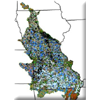
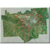
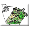
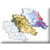
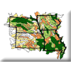
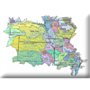
Ecological Systems Mapping for Nebraska and Kansas
MoRAP worked with partners in Nebraska and Kansas to produce a uniform, consistent, fine-resolution Ecological Classification System (ECS) dataset for Nebraska and Kansas. The goal is to have a hierarchical landcover that accurately maps terrestrial upland habitats to the ecological systems level (National Vegetation Classification System-NVCS Alliance level 2016) and wetlands to National Wetlands Inventory (USFWS 2016) class level, while incorporating the Terrestrial Ecological Systems and Natural Communities of Nebraska (Rolfsmeier and Steinauer 2010) as well as possible.
Mapping at this level provides critical information for conservation planning, project review, development of species distribution models, and development of Decision Support Tools to guide on-the-ground conservation delivery. Mapping at this level is also consistent with the landcover datasets that have been developed for Texas (Diamond and Elliott 2010) and Oklahoma (Diamond and Elliott 2015), in partnership with the Great Plains LCC. Consistent landcover data across the Great Plains and ensures that accurate and applicable landscape conservation design products can be developed to guide future actions of our partnerships.
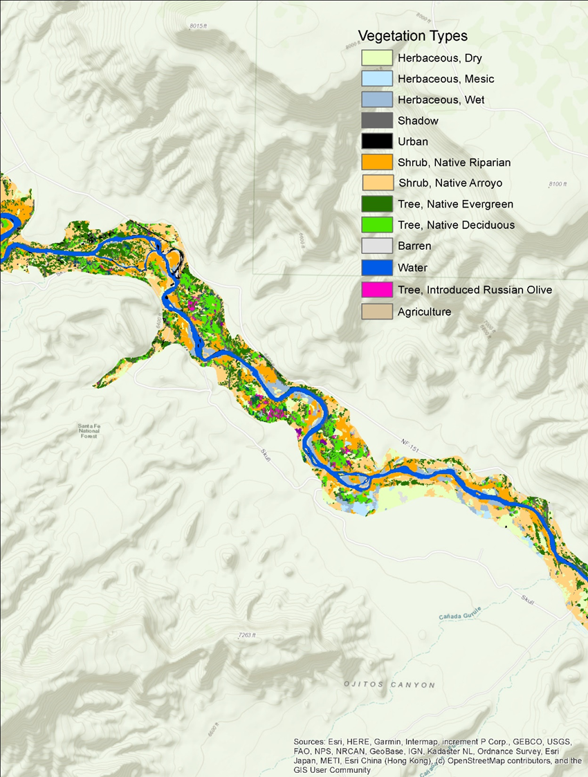
Riparian and wetland habitats are vitally important to New Mexico’s fish and wildlife, yet they are among the rarest habitats in the state. Despite their small area, most of New Mexico’s vertebrate species depend on riparian areas for food, water, cover, and/or migration routes. These habitats are also among the most threatened, as they are fairly sensitive to disturbance and change.
MoRAP worked with partners in New Mexico to develop statewide riparian and wetland maps using a combination of high-resolution imagery, machine learning, and environmental modeling approaches. These maps delineate the composition, cover, and structure of riparian and wetland vegetation at a fine scale across New Mexico, including the location and extent of invasive species such as salt cedar. They also provide a baseline for tracking tamarisk leaf beetle impacts and their severity, indicate where restoration if urgently needed to prevent habitat loss, and support fish and wildlife surveys and monitoring. Additionally, the maps include ecological descriptions to support wildlife management and restoration across the full range of riparian and wetland habitat conditions in the state.
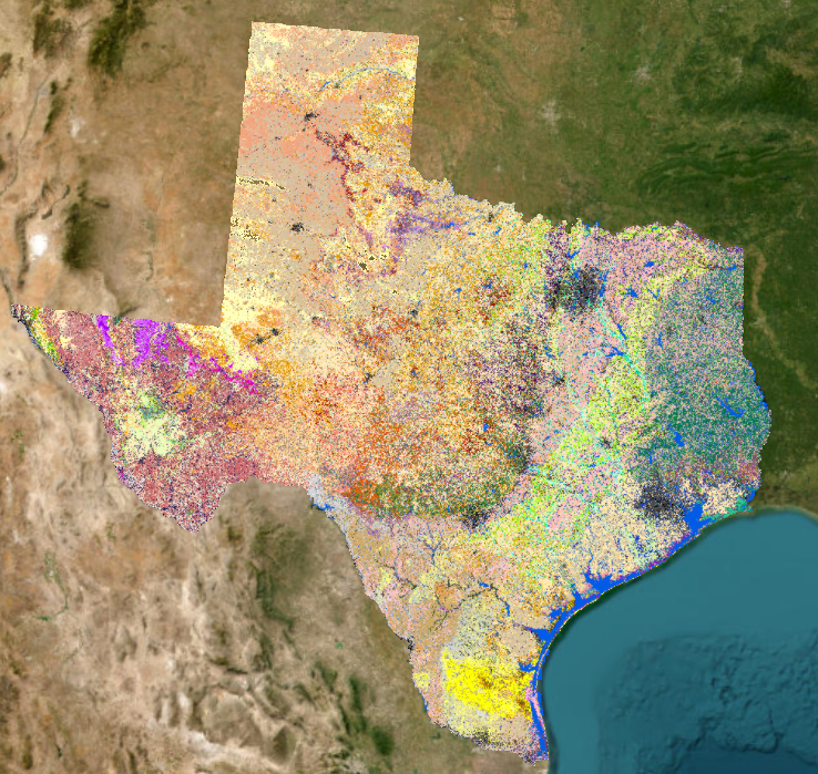
MoRAP worked with the Texas A&M Forest Service (TFS) to create the input datasets necessary to update the surface and canopy fuels for the Texas Wildfire Risk Assessment using the latest technology and methods. These datasets included land-cover, ecological systems models, and percentage canopy cover at 10 meters across the state of Texas. The purpose of the Texas Wildfire Risk Assessment is to provide wildfire risk information and create awareness about wildfire issues across the state.
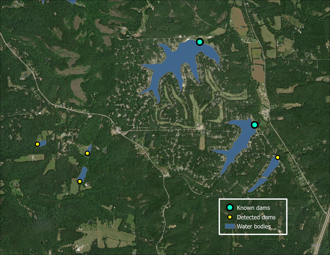
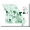
Update the National Inventory of Dams for Missouri
MoRAP worked in partnership with the Missouri Department of Natural Resources (MDNR) to update the National Inventory of Dams (NID) for numerous Missouri counties. Results help provide information that will be used to estimate the cost and time required to complete the NID for the entire state, as well as to identify unregulated dams using semi-automated approaches.
Other Past Projects…
Functional Assessment of Missouri’s Wetlands
MoRAP is working with the Missouri Department of Conservation (MDC) on a functional assessment of Missouri wetlands. Mapping will be done on bottomlands in Missouri that support most of the current and historic wetlands, including the Mississippi and Missouri River bottomlands and associated larger river bottomlands.
–
Texas-Oklahoma Landcover Enhancement
The landcover maps of Oklahoma and Texas will be seamlessly joined to create a single map. We will address gaps between the state datasets, overlaps between the datasets, and differences in naming and mapping concepts between the datasets. Click Here for More Information
–
An Eco-Logical Approach to Infrastructure Development for the East-West Gateway Council of Governments
The East-West Gateway Council of Governments and partners are working with MoRAP to develop a fine-resolution ecological significance data layer to facilitate an ecological approach to infrastructure development.
The Missouri Aquatic Gap Project developed methods to identify species, habitats, and ecosystems not adequately represented within existing conservation lands.
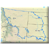
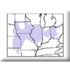
Aquatic Species Distribution Modeling and Threat Analysis in the Northwestern Plains Ecoregion
MoRAP will assist Science Applications International Corporation (SAIC) with completing a Rapid Ecoregional Assessment for BLM by providing species distribution models and a threat assessment for the Missouri River basin portion of the Northwestern Plains Ecoregion.
Assessing the Effects of Conservation Practices on Aquatic Biota in the Missouri River Basin
This project will assess the effectiveness of NRCS conservation practices at conserving flowing-water (lotic) fish assemblages throughout the Missouri River Basin.
Assessment of Natural Resources and Watershed Conditions for Selected National Park Service Lands
This project will utilize existing scientific data from multiple sources, combined with best professional judgment from an interdisciplinary team of specialists, to evaluate overall functional status and integrity of terrestrial and aqautic resources within each park.
Central Hardwoods Bird Conservation Region Assessment
The Central Hardwoods region, including the Ozark Highlands, may be a source for populations of forest birds, and also contains important habitat for species that live in non-forested habitat. MoRAP is working with the American Bird Conservancy and others to help identify the most significant areas for bird conservation in the region.
Change Detection and Improved Wetlands Mapping for the East-West Gateway Council of Governments
MoRAP, East-West Gateway staff, and partners were working to improve wetland maps and wetland conservation planning materials for the region, and to ensure that current vegetation maps are as up to date as possible.
Ecological focus areas will be identified by assessing terrestrial and aquatic ecosystems separately. Each 30m pixel will have a value for significance, threat, and overall risk.
MoRAP uses landcover and roads data layers to create distance grids for roads and natural landcover types, and then identifies conservation opportunity areas based on these flexible data layers. When these polygons are ranked using different conservation targets (landform representation, total vertebrate diversity, target bird diversity, rare species, target landcover class), the apparent high priority areas do not overlap as much as expected.
Contamination Characterization through Airborne Hyperspectral Imaging
This is a proof of concept pilot project to determine if hyperspectral imagery can enhance Missouri’s and other state’s ability to conduct large scale characterization of contaminants of concern. MoRAP received public recognition for contributions to this groundbreaking project.
Critical Evaluation of Methods and Outcomes for Habitat/Ecological Systems Classification and Mapping in the Northeast and Midwest U.S.
Several large-scale mapping projects have been completed in the U.S. Map ranges often overlap. To address the question of how to use these multiple products effectively, the Northeast Climate Science Center (NECSC) funded a project to critically evaluate these ecosystem or habitat mapping methods and to move toward standardization of these maps.
MoRAP identified high conservation value (HCV) and high restoration value forests in the Cumberland Plateau based on methods developed for the Opportunity Area Inventory and Landform Modeling projects.
Data Development for Grassland Decision Support Tool
The objectives of this project are to identify landscapes of importance at appropriate scale for further work, and to develop GIS data and decision-support tools to facilitate further conservation efforts within the Gulf Coast Prairie Land Conservation Cooperative.
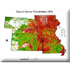
Developing Reach Specific Watershed Data on Nonpoint Pollution Sources
The primary purpose of this project was to gather and quantify geospatial data layers pertaining to anthropogenic features on that landscape that threaten the ecological integrity of Missouri’s streams. As such the scope of this project was largely that of data development in which we quantified threats in the drainage area above each stream segment in Missouri using a modified version of the 1:100,000 National Hydrography Dataset (NHD).
Developing Synoptic Human Threat Indices for Assessing the Ecological Integrity of Freshwater Ecosystems in EPA Region 7
The primary purpose of this project is to develop reach scale GIS-based Synoptic Human Threat Indices (HTI) for assessing the aquatic ecological integrity within EPA Region 7.
Eastern Tallgrass Prairie Bird Conservation Region
MoRAP will analyze data layers in order to suggest landscape priorities and spatially explicit target conservation opportunity areas and provide a geographic information system (GIS) for evaluating conservation alternatives.
The conservation of Missouri’s rich array of native plant and animal species will require the maintenance and enhancement of the native ecosystems they depend on. Regional and landscape ecosystems for Missouri have been derived using the United States Forest Service approach to ecological classification.
MoRAP used landcover, roads, public land ownership, and other data layers to identify areas in the Missouri Ozarks where the re-introduction of elk might be possible.
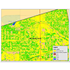
Fine-resolution Urban Land Use/Landcover Data Development for the St. Louis Region
MoRAP is working with the East-West Council of Governments to develop a fine-resolution land use/landcover dataset covering urban areas in the St. Louis region.
Forest productivity is impacted both by abiotic variables and by the characteristics of the forest stand on a given site; productivity may be reduced when forest stand type is not matched with the site potential (e.g. deciduous stands on sites where evergreens grow best).
The Forestry Infomart was initiated in 2000 as a part of the NASA/Raytheon Synergy project. We develop and delivery information to inform decision support systems and impact natural resource management policy. Primary federal partners include the USFS, EPA, USGS, NRCS, and USFWS.
The Geographic Resources Center at the University of Missouri is using historic land survey data to model historic vegetation in Missouri. For more information email Jim Harlan at harlanj@missouri.edu.
The sensitivity atlas provides easily accessible digital and hard copy atlases for EPA Region 7, specifically the Missouri river, that pinpoint natural species, environmental hazards, and political boundaries both in the river and on the floodplain; this format allows planners an accurate inventory of the significant areas of the corridor so that risks can be avoided or recognized and mitigated.
James River Basin Information Development and Delivery
MoRAP is working with staff from EPA, the James River Basin Partnership (JRBP), and NRCS to address the need to protect and improve overall environmental and water quality in the face of a rapidly expanding human population in the watershed. MoRAP will provide information for the JRBP to use in developing watershed plans, regional water quality recommendations, and educational programs.
Lead mining in Missouri has resulted in local environmental degradation; MoRAP is working with partners to map the location, extent, and impacts of past mining activities in Jasper County.
MoRAP modeled landforms of Kansas based on 30-meter digital elevation models, and used existing ecoregion delineations to draft a land type association (LTA) data layer for Kansas.
Timely, regular up-dates of ETM+-based landcover data are desired by partner agencies in an effort to aid accurate decision-making, therefore leading to effective natural resource management. A flexible methodology was developed that allowed for customization of the landcover product based on partner inputs (value added landcover mapping).
Landform variation (plains versus hills versus rough breaks) controls patterns of land use and vegetation. MoRAP is using Digital Elevation Models (DEMs) to characterize landforms.
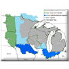
Midwest Glacial Lakes Partnership Lakeshed Data Suite Development
The Missouri Resource Assessment Partnership (MoRAP) performed work for the Midwest Glacial Lakes Partnership (MGLP), a Fish Habitat Partnership, that consisted of developing datasets to be used for their fish habitat assessments.
The rate of forest harvesting in the heart of the Ozarks has significant environmental and economic impacts. MoRAP is working with MDC and partners to determine harvest rates for an eight-county area.
The principal goal of our project was to identify riverine ecosystems and species not adequately represented (i.e., gaps) in the matrix of conservation lands in the Missouri River Basin.
Missouri Statewide Current Vegetation Mapping at Fine Spatial and Thematic Resolution
Recent advances in remote sensing software, coupled with results from the current MDC/NRCS Ecological Classification System project and lessons learned from similar projects, will allow us to develop this fine spatial- and thematic-resolution existing vegetation map.
Development of a Comprehensive Conservation Strategy for Missouri
MoRAP is working with the Missouri Department of Conservation (MDC) to facilitate the development of a Comprehensive Conservation Strategy for Missouri.
Current vegetation of Oklahoma will be mapped at fine spatial and thematic resolution using satellite remote sensing, image objects created from air photos, and modeling from abiotic variables.
Pilot Project for the Update of Ecological Mapping Systems of Texas and Analysis of Amount and Type of Habitat Change with Respect to the Endangered Golden Cheeked Warbler
This is a cooperative project between the Texas Parks and Wildlife Department and Dr. David Diamond, Ph.D., to update the Ecological mapping Systems of Texas (EMS_T) Database from 2007 to 2014 for evaluation of the amount of urban development and vegetation community change in and near identified critical habitat of Golden Cheeked Warbler – GCWA (Setophaga chrysoparia).
This project uses available locality records and land use/landcover maps to estimate the spatial distribution of select vegetation types known to be inhabited by Aplomado Falcon.
The location of public lands, and the juxtaposition of various public land ownerships in relation to each other and in relation to significant natural features is of conservation and managment concern. We are currently up-dating the existing circa 1996 coverage.
Restoration and Protection of Missouri River Wetlands
This project will develop methods and provide results to identify and quantify extant wetlands, recent wetland trends, and potential wetland restoration sites along a reach of the Missouri River from approximately Atchison to Kansas City.
Create a high resolution Ruffed Grouse habitat map for a study area extending from Highway 63 on the west to easternmost Warren County boundary, and from Interstate 70 on the north and the Missouri River on the south.
This project is a collaborative effort between MoRAP and MoDOT to take existing SEMA buy-out lands data and put it into a geodatabase in order for it to better serve MoDOT’s needs.
Strategic Highway Research Program (SHRP) Data Development for Transportation Planning in the St. Louis Region
We developed a high spatial resolution Land Use/Landcover (LULC) dataset to aid in an improved preliminary assessment of the environmental impact of proposed transportation development projects. Refined spatial resolution LULC will allow for a more accurate consideration of vegetation and impervious surface in an urban environment compared to previous coarse resolution LULC.
MoRAP is working to modify and improve the results of a synoptic hydrologic unit ranking model based on wetland values that was developed by the EPA for Region 7. Results will be made relevant and delivered on a state-by-state basis.
Texas Ecological Classification System Mapping Project
The U.S. Forest Service, National Forests and Grasslands in Texas, wants spatially-specific maps of Ecological Classification System concepts to facilitate planning and management.
Ecological systems classification for Texas will be produced by first classifying the existing vegetation, and then modeling the ecological systems by overlaying data such as land position, slope, aspect, and soil type.
The Texas A&M Forest Service seeks to improve fuel model mapping and associated wildfire outputs for Texas, and MoRAP will provide ecological expertise and interpretations to aid this effort.
The Imperiled Coldwater Crayfish (Orconectes eupunctus) in the Black River Drainage of Missouri and Arkansas
MoRAP will work with the Missouri Department of Conservation and the Arkansas Cooperative Fish & Wildlife Research Unit to gather and quantify both natural and anthropogenic data relative to the distribution of the Coldwater Crayfish (Orconectes eupunctus) within the Spring River, Eleven Point, Strawberry River and lower Black River drainages.
Update of PAD-US (Protected Areas Database of the United States) for Missouri
The purpose of this project is to develop and update a protected areas geodatabase for Missouri that will contribute to the up-date of the overall Protected Areas Database of the United States (PAD-US).
Rapid urban growth or ‘sprawl’ has impacted relatively large areas within EPA Region 7. MoRAP has used Landsat imagery dating back to 1972 and through 2000 to quantify the amount of urban change that has occured in several metropolitan areas.
Use of Enduring Features to Inform Conservation Actions in Relation to Climate Change
Due to the uncertainty of future climatic patterns and species responses, enduring features of the landscape (geophysical settings) are appropriate targets of assessment, planning, and conservation.
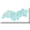
Using GIS and an Aquatic Ecological Classification System to Classify and Map Distinct Riverine Ecosystems throughout EPA Region 7
The overall objective of this project was to use the GIS-based methods developed by Sowa et al. (2005) to classify and map levels 4 through 7 of the MoRAP riverine classification hierarchy for Iowa, Kansas, and Nebraska—which completes the classification of these ecological units for EPA Region 7.
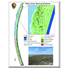
Vegetation Mapping for National Park Service-Padre Island
This project is part of a nationwide effort by NPS to provide fine-resolution current vegetation maps for all NPS lands. Maps will be based on quantitative field data, analyses, and georeferenced polygons that circumscribe community types developed from photointerpretation for Padre Island National Seashore.
Vegetation Mapping for National Park Service-Phase 1
This project was part of a nationwide effort by NPS to provide fine-resolution current vegetation maps for all NPS lands. Maps were based on quantitative field data, analyses, and georeferenced polygons that circumscribe community types developed from photointerpretation for George Washington Carver National Monument, Pea Ridge Military Park, and Wilson’s Creek National Battlefield.
Vegetation Mapping for National Park Service-Phase 2
This project was part of a nationwide effort by NPS to provide fine-resolution current vegetation maps for all NPS lands. Maps were based on quantitative field data, analyses, and georeferenced polygons that circumscribe community types developed from photointerpretation for Herbert Hoover National Historic Site, Hopewell Culture National Historic Park, Lincoln Boyhood National Memorial, and Pipestone National Monument.
Vegetation Mapping for National Park Service-Phase 3
This project was part of a nationwide effort by NPS to provide fine-resolution current vegetation maps for all NPS lands. Maps were based on quantitative field data, analyses, and georeferenced polygons that circumscribe community types developed from photointerpretation for Hot Springs National Park and Arkansas Post National Memorial.
The Geographic Resources Center at the University of Missouri completed Missouri’s Gap Analysis project. As part of the project, models that predict the probability of occurrence of vertebrates across the state were completed. Email Tim Haithcoat at haithcoatt@missouri.edu or contact the National Gap Analysis home page (http://gap.uidaho.edu) for more information.
Watersheds versus Ecoregions for Environmental Assessment
MoRAP is attaching landscape metrics generated from landcover to watershed and ecoregion polygons to test the validity of each as a conservation assessment tool.
The Wetland Image Analysis Project serves as a ‘buyer’s guide’ for those interested in idenfication of wetlands via remote sensing platforms. Six differnet remote sensing platorms were tested in terms of their utility to extract information on different wetland types.
Wetlands Mapping of the Meramec River and Upper Silver Creek Watershed
Morap will participate with the East-West Gateway Council of Governments staff to provide wetlands mapping of the Meramec River and Upper Silver Creek.
The ranking of wildlife conservation opportunity areas represents the interaction between what is most critically needed and what is most practically doable; we will develop base information on biological significance so others can add more detailed information on both need and practical opportunities to rank overall conservation opportunity.