
Objectives
- Identify areas of recent urban development.
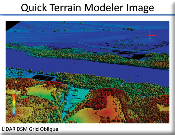
- Improve wetland maps for the Missouri River floodplain.
- Improve wetland mitigation and restoration modeling based on new wetland maps.
MoRAP and staff at the East-West Gateway Council of Governments will build on previous work to provide improved information for planning. Rapid urban development in some areas warrants a change detection analysis to keep maps of current vegetation provided earlier up to date. Wetlands are of special concern because they are subject to federal regulation, and most wetlands within the region occur on river floodplains. The availability of LiDAR data makes possible better wetlands mapping for the Missouri River floodplain.