
Objectives
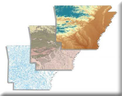
- Classify stream segments contained within the 1:100,000 National Hydrography Dataset (NDH) into distinct valley segment types according to distinct combinations of factors known to individually and collectively influence local biophysical conditions.
- Generate stream reach specific drainage area polygons (catchments/segmentsheds) for each primary channel stream segment in the 1:100,000 scale NHD.
- Generate local and watershed statistics pertaining to soils, geology, and landform for every stream segment in the NHD.
- Compile existing fish sampling data collected from streams across Arkansas.
- Enter or transfer compiled data into a Microsoft Access relational database.
- Link each sampling record to the USGS/EPA National Hydrography Dataset and the USGS/NRCS Hydrologic Unit Coverage.
- Develop professionally reviewed range maps for all fish species by 8 or 11-digit HU.
- Develop predictive distribution models and maps showing the stream segments each fish species is likely to occur in under relatively natural conditions in Arkansas.
The Missouri Resource Assessment Partnership (MoRAP) and The Nature Conservancy (TNC) propose to create stream reach-scale distribution models for all fish species known to occur in the state of Arkansas. This project requires compiling biological sampling data from various sources in Arkansas and characterizing the local and watershed conditions of every stream segment in the 1:100,000 scale National Hydrography Dataset (NHD). These data will then be utilized to model fish species affinities to particular local and watershed characteristics (habitats) within the species’ range. Maps and a GIS database will be generated to identify all the suitable habitats for these species throughout their professionally reviewed range in Arkansas. Deliverables will include a relational database of fish community sampling data, modified 1:100,000 NHD stream networks with local and watershed metrics, GIS datasets of all the species model results, and maps of the resulting species models. The resulting stream network and species models are two critical components for conducting an aquatic gap analysis. This project will be a joint effort with MoRAP taking on most tasks pertaining to stream classification and attribution while TNC will undertake most of the work pertaining to assembling the species collection information and development of the species models with limited assistance from MoRAP.
This project was completed jointly with TNC staff from Arkansas and models with associated data were provided to all partners for use in conservation planning.