

Objectives
- Develop lakesheds for the MGLP portion of North Dakota and South Dakota.
- Assemble the final MGLP lakeshed data suite geodatabase covering the entire MGLP geography.
- Seamlessly integrate lakeshed delineations along the Wisconsin/Illinois border and along the Illinois/Indiana border.
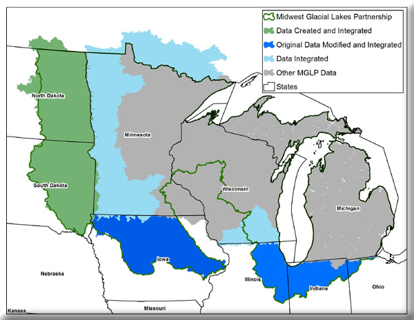
The Missouri Resource Assessment Partnership (MoRAP) performed work for the Midwest Glacial Lakes Partnership (MGLP), a Fish Habitat Partnership, that consisted of developing datasets to be used for their fish habitat assessments. This work was funded by the U.S. Fish and Wildlife Service. The work consisted of completing lakeshed delineations for North Dakota and South Dakota and integrating existing lakeshed data along the Wisconsin/Illinois border and the Illinois/Indiana border. Finally, MoRAP assembled the final MGLP lakeshed data suite geodatabase for the entire MGLP geography. This project was completed in September of 2011.