
Objectives
- Identify known contaminated sites.
- Collect hyperspectral imagery of a set of those known contaminated sites.
- Analyze the imagery and develop hyperspectral signatures of the contaminants or environmental conditions.
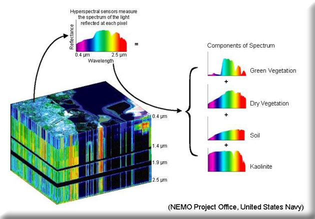
Locating, characterizing and identifying the extent of a broad spectrum of chemical contamination is critical and directly affects the health and welfare of Missouri’s citizens and the environment. It is critical and time sensitive when the contamination is the result of an accident or deliberate incident. Today, most of the work of locating and identifying the extent of contamination is done manually with portable instruments or by collecting samples for post analysis. Technologies and collection platforms, specifically airborne hyperspectral imagery, are available that may automate the process and increase the amount of area that can be searched. Hyperspectral remote sensing has been used for mineral exploration, hazardous waste remediation, ecosystem monitoring and a variety of other large scale characterization initiatives. This project will acquire commercial airborne hyperspectral imagery of known contaminated sites, and analyze and assess the utility of that imagery to the characterization of contaminants.