
![]()
Objectives
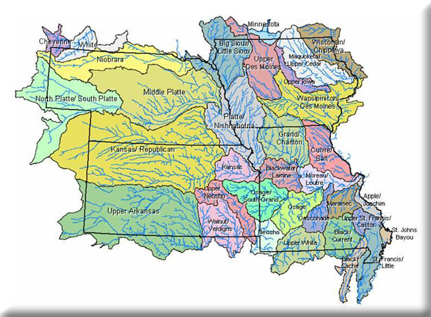
- Use the GIS-based methods developed by Sowa et al. (2005) to classify and map levels 4 through 7 of the MoRAP riverine classification hierarchy for Iowa, Kansas, and Nebraska—which would complete the classification of these ecological units for EPA Region 7.
- Provide training to personnel from EPA Region 7 and from monitoring programs in Nebraska on how to use the resulting geospatial datalayers and the associated attribute tables to assist with research, management, and biomonitoring efforts.
The overall objective of this project was to use the GIS-based methods developed by Sowa et al. (2005) to classify and map levels 4 through 7 of the MoRAP riverine classification hierarchy for Iowa, Kansas, and Nebraska—which would complete the classification of these ecological units for EPA Region 7. The specific set of deliverables established for this project include:
- 1:100,000 ArcView coverage of Aquatic Subregions for Region 7
- 1:100,000 ArcView coverage of EDUs for Region 7
- 1:100,000 ArcView coverage of AES-Types for Region 7
- 1:100,000 ArcView coverage of Valley Segment Types for Region 7
- Metadata for each coverage
- Written descriptions for each Aquatic Subregion, EDU, and AES-Type
- Written report of classification methods for each level of the hierarchy
Project completed September 2006
Project Files
-
To request a final report or other documents available for this project click the link. Please include the name of the project in your request.
- MoRAP Contact Information