
![]()
Objectives
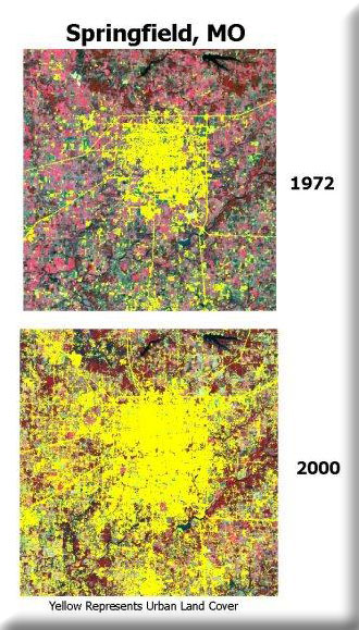
- Quantify the impacts of change in the St. Louis, Kansas City, Springfield and Omaha/Coucil Bluffs metropolitan areas using remotely sensed data.
- Provide innovative methods to help visualize urban growth.
- Provide for delivery of information to planners and managers.
Rapid urban growth or ‘sprawl’ has impacted relatively large areas within EPA Region 7. MoRAP has used Landsat imagery dating back to 1972 and through 2000 to quantify the amount of urban change that has occured in several metropolitan areas.