
Objectives
- Develop a new, fine-resolution land use/landcover data layer for two urban areas in order to refine methodogy.
- Test the utility of resulting data via review by partners.
- Incorporate the new data into a data delivery tool that is being developed by partners at the national level.
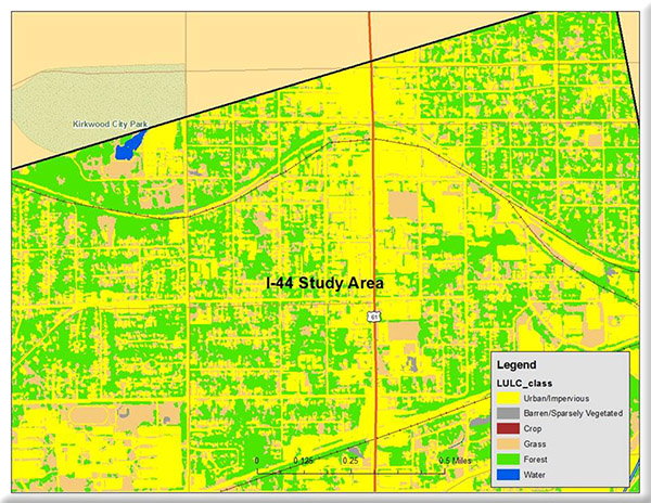
We developed a high spatial resolution Land Use/Landcover (LULC) dataset to aid in an improved preliminary assessment of the environmental impact of proposed transportation development projects. Refined spatial resolution LULC will allow for a more accurate consideration of vegetation and impervious surface in an urban environment compared to previous coarse resolution LULC.