
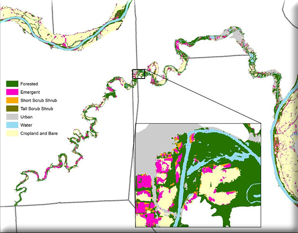
Morap will participate with the East-West Gateway Council of Governments staff to provide wetlands mapping of the Meramec River flood plain bluff-to-bluff from the Franklin/Crawford county line to the Mississippi River, and seven contiguous Upper Silver Creek HUC12 subwatersheds in eastern Madison and St. Clair Counties from south of the Macoupin County line to north of Scott Air Force Base. An end product of this project will be a very fine resolution map of existing wetland importance and restoration potential.
This scope of work represents the on-going maintenance and enhancement of work products related to the ecological framework and watershed mitigation and restoration data layers as identified in the Ecological Approach to Infrastructure Development Initiative. An objective of the initiative is to support implementation of ecosystem based mitigation, multiple-project mitigation, and innovative project-specific/low-impact design mitigation strategies.