
Objectives
- Collaborate with James River Basin Partnership and watershed stakeholders to develop relevant, easily understood, natural resource information.
- Develop data and analyses that address environmental quality issues including the identification of natural, semi-natural, and agricultural opportunity areas.
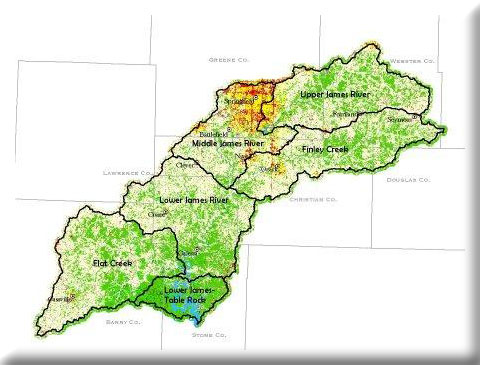
We used landcover, modeled landforms, and landscape context to identify conservation opportunity areas (OAs) within the James River Basin for the James River Basin Partnership. The central and eastern parts of the Upper James River and Finley Creek watershes contain more OAs versus the western third and the southern part of the Lower James River watershed contains more OAs than the rest.
Project Files
-
To request a final report or other documents available for this project click the link. Please include the name of the project in your request.
- MoRAP Contact Information