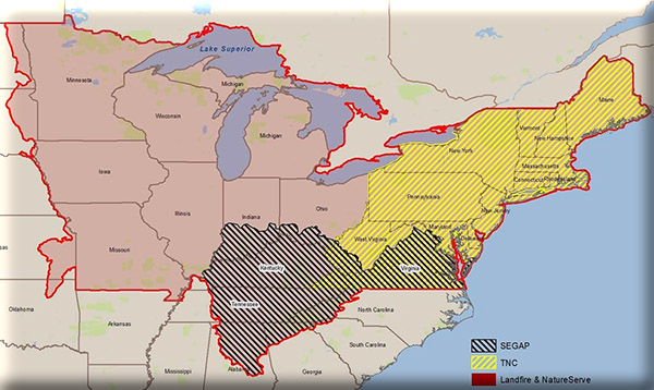
A number of large-scale mapping projects have been completed in the U.S., and several cover all or some parts of the footprint of the Northeast Climate Science Center (NECSC). In a number of cases, the ranges of these maps overlap. As a result, staffs of resource management agencies and organizations are faced with trying to determine how to use these multiple products to effectively and efficiently meet their needs. To address this question in the northeast and Midwest U.S., the Northeast Climate Science Center (NECSC) funded a project to critically evaluate these ecosystem or habitat mapping methods and to move toward standardization of these maps. The objectives of the project were to:
- Phase 1: Review and compare existing map products;
- Phase II: Extend the map legends & identify legend elements (ecosystems) most vulnerable to climate change;
- Phase III: Develop recommendations for an improved map for the region, and
- Phase IV: Produce an improved regional map
Project Files
-
To request a final report or other documents available for this project click the link. Please include the name of the project in your request.
- MoRAP Contact Information
