![]()

Objectives
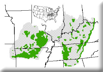
- Characterize the Central Hardwood Bird Conservation Region in terms of landcover.
- Use GIS to quantitatively identify those areas most significant for bird conservation.
- Integrate and deliver information for practical use by planners and managers.
We provided GIS data for regional meetings of The Central Hardwoods Bird Conservation Region planning group. Bird conservation planning is an iterative process, and is being coordinated by the American Bird Conservancy for this area, which included the Ozark Highlands and Interior Low Plateaus to the east.
