
There has been a tremendous amount of geospatial data developed over the last decade, much of which represents anthropogenic features on the landscape than have the potential to threaten the ecological integrity of streams. What has been lacking is a means of assembling, organizing, and quantifying this data in a fashion that will provide information relevant to each stream segment.
To help address this information gap the primary purpose of this project was to gather and quantify geospatial data layers pertaining to anthropogenic features on that landscape that threaten the ecological integrity of Missouri’s streams. As such the scope of this project was largely that of data development in which we quantified threats in the drainage area above each stream segment in Missouri using a modified version of the 1:100,000 National Hydrography Dataset (NHD).
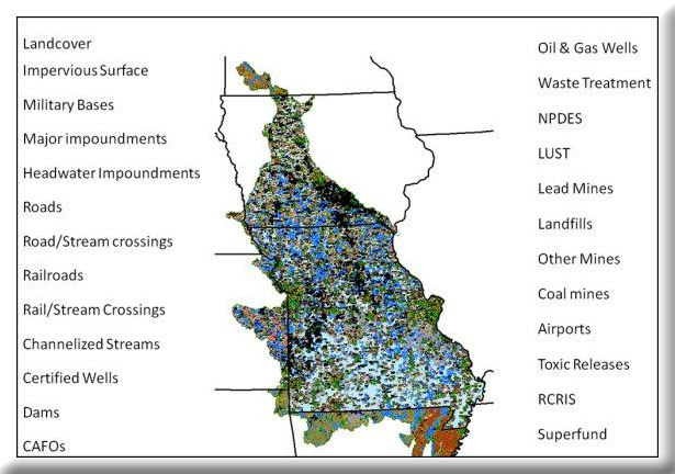
Approximately 40 geospatial data layers were identified through the help of a regional oversight committee that was brought together to provide guidance for this project and another related project that is being conducted over all of EPA Region 7. This committee consisted of individuals from each of the states comprising EPA Region 7 (Iowa, Kansas, Missouri, and Nebraska). A large thrust of this project was to collect and assemble data layers that were seamless across state boundaries. These seamless data layers allow information for watersheds that straddle state boundaries to have information quantified accurately for the drainage area above each stream segment.
A total of three training workshops were hosted as part of the project. These sessions were intended to provide end users with an overview of the data as well as allow them to work with the data in a hands-on GIS environment. A special training manual with student exercises and data CD were developed especially for these training sessions.
Building on the idea that accurate inventories can lead to better understanding and better understanding in turn leads to better decision making, it is our hope that the information assembled as part of this project will provide aquatic resource managers with the information they need to make more informed and objective decisions about Missouri’s riverine ecosystems.
Project Files
- MoRAP Contact Information
To request a final report or other documents available for this project click the link. Please include the name of the project in your request.