

Objectives
- Increase coordination among state, federal and local stakeholders in EPA Region 7 with regards to broad-scale assessments of the ecological integrity of freshwater resources.
- Increase knowledge about the availability and limitations of existing geospatial data pertaining to human threats and GIS-based methods of environmental assessment.
- Develop a centralized repository of the most accurate and recent geospatial data pertaining to human threats within EPA Region 7 in order to increase efficiency and standardization of efforts to document, prevent, reduce and eliminate water pollution.
- Quantify the number, density, areal extent, and percentages for a variety of human land uses for every stream reach contained in the 1:100,000 NHD within Iowa, Kansas, and Nebraska.
- Develop scientifically rigorous, standardized, and regionally accepted synoptic indices that can be practically applied within a GIS and account for;
a. local, watershed, and upstream riparian disturbances that negatively affect ecological integrity of surface waters, and
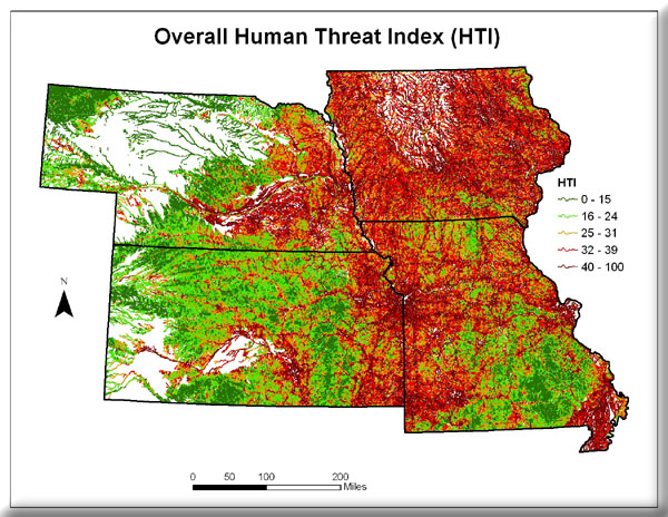
b. differences in the magnitude and type of disturbance among all possible human threats that are identified. - Calculate the resulting Synoptic Human Threat Indices for every stream reach contained in the 1:100,000 NHD within EPA Region 7.
- Validate the accuracy of the resulting Synoptic Human Threat Indices.
Funding for this project was provided by a U.S. Environmental Protection Agency Region VII Wetland Program Development Grant; additionally, the U.S. Environmental Protection Agency Region VII, through the Missouri Department of Natural Resources, has provided partial funding for this project Under Section 319 of the Clean Water Act.
Project completed.
Project Files
- MoRAP Contact Information
To request a final report or other documents available for this project click the link. Please include the name of the project in your request.
