
Objectives
- Define landfoms based on neighborhood analysis of digital elevation models.
- Integrate landform models with landcover and other information to evaluate patterns and facilitate natural resource inventory and management.
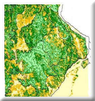
Landform variation (plains versus hills versus rough breaks) controls patterns of land use and vegetation. MoRAP is using Digital Elevation Models (DEMs) to characterize landforms; the results are intersected with landcover from Remote Sensing to help us better understand vegetation patterns.